|
 |
Warren County Genealogical Society
Warren County, Ohio
Chapter of Ohio Genealogical Society
Property Searches
Using the Map Feature |
 |
|
(513) 695-1144
 |
406 Justice Drive, Lebanon, Ohio 45036
Hours: 9 AM-4 PM Monday through Friday
Driving Directions |
wcgs@co.warren.oh.us
 |
|
 |
This page contains information about property
searches in Warren County, Ohio. If you are searching for land records and
need help, please contact our
research
department and we will assist you in finding what you need.
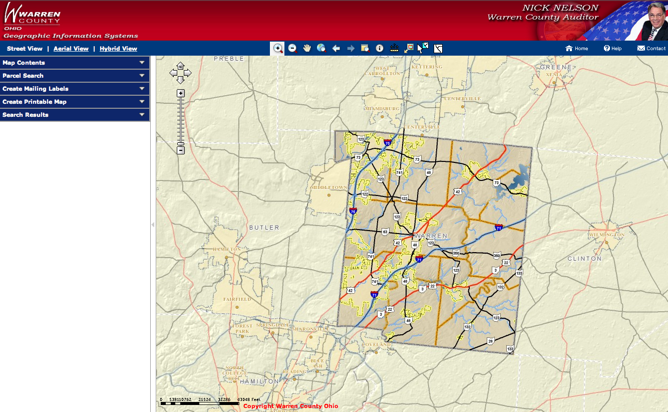
http://webmap.co.warren.oh.us/AuditorGIS/default.aspx
Searches done by maps are immensely
helpful. These can be done if you know roughly where your ancestor lived or
died or if you know the property account number. It is much easier to find it
you know the street name. Click on the link for the map at the top of the
property search page. To use the map features you will need to disable any
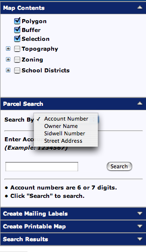
popup blockers on your computer. Four types of searches can be done: by
account number, owners name, parcel ID (sidwell) number, or street address.
You should first find the property account number from property search
features on the combined auditor’s and recorder’s search website rather than
using the map feature. Under the category ‘Parcel Search” select account
number and type it in and press “Search”. If you choose to enter the account
number, make sure that is the number entered. The account number and parcel
ID (sidwell number) are not the same thing.
 |
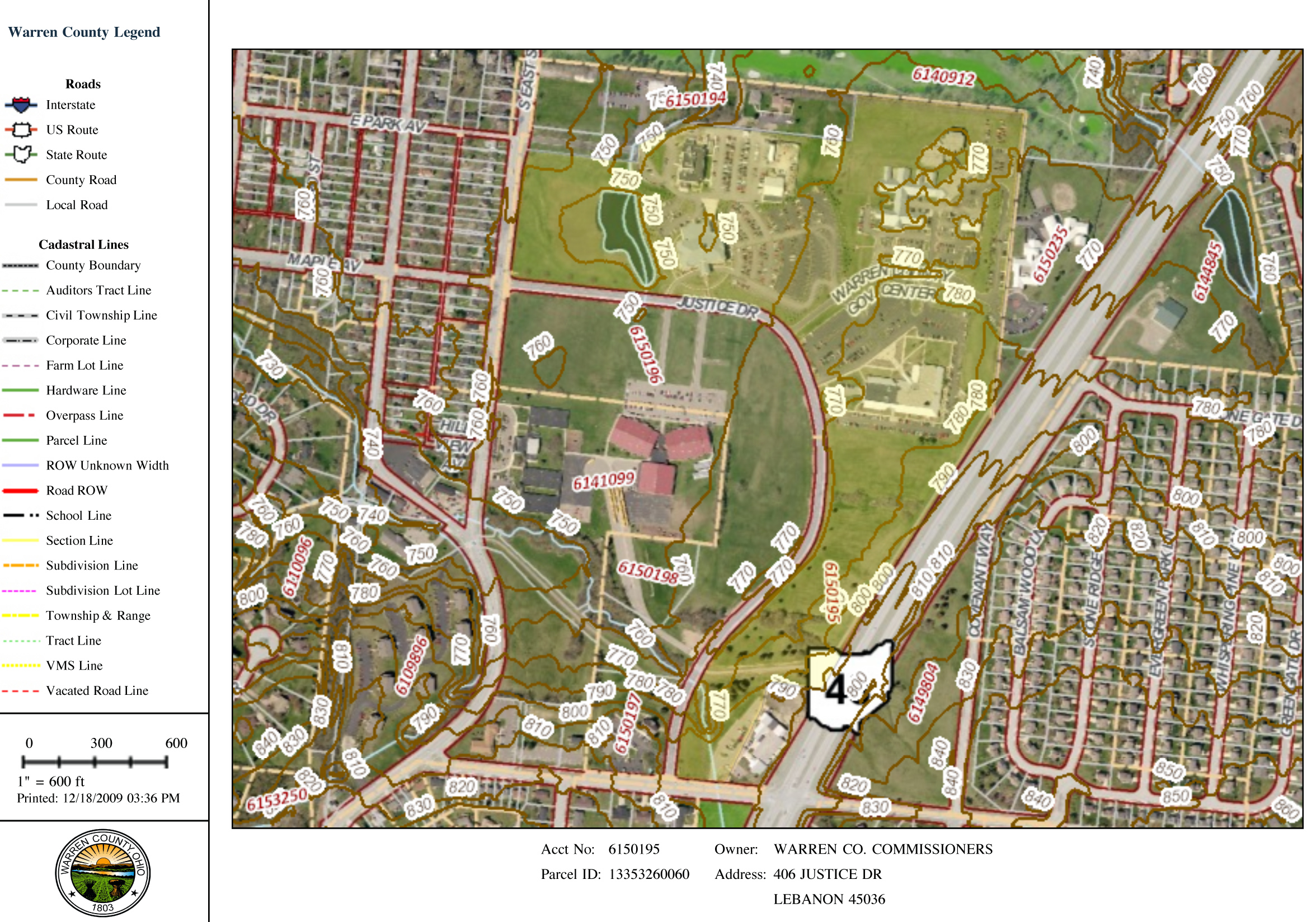
There are many layers available to add to
your map. The hybrid view is my favorite because it shows what the lay of the
land really looks like, where the road and township boundaries fall, and what
are the properties boundaries. The map searching function can help you find
the property you are searching as well as neighbors. Some of the optional
layers are topography, zoning and school districts. The map search feature is
extremely useful for finding directions to cemeteries. The topography view is
especially helpful for cemeteries to help identify where in the wooded areas
you really found it.
 |
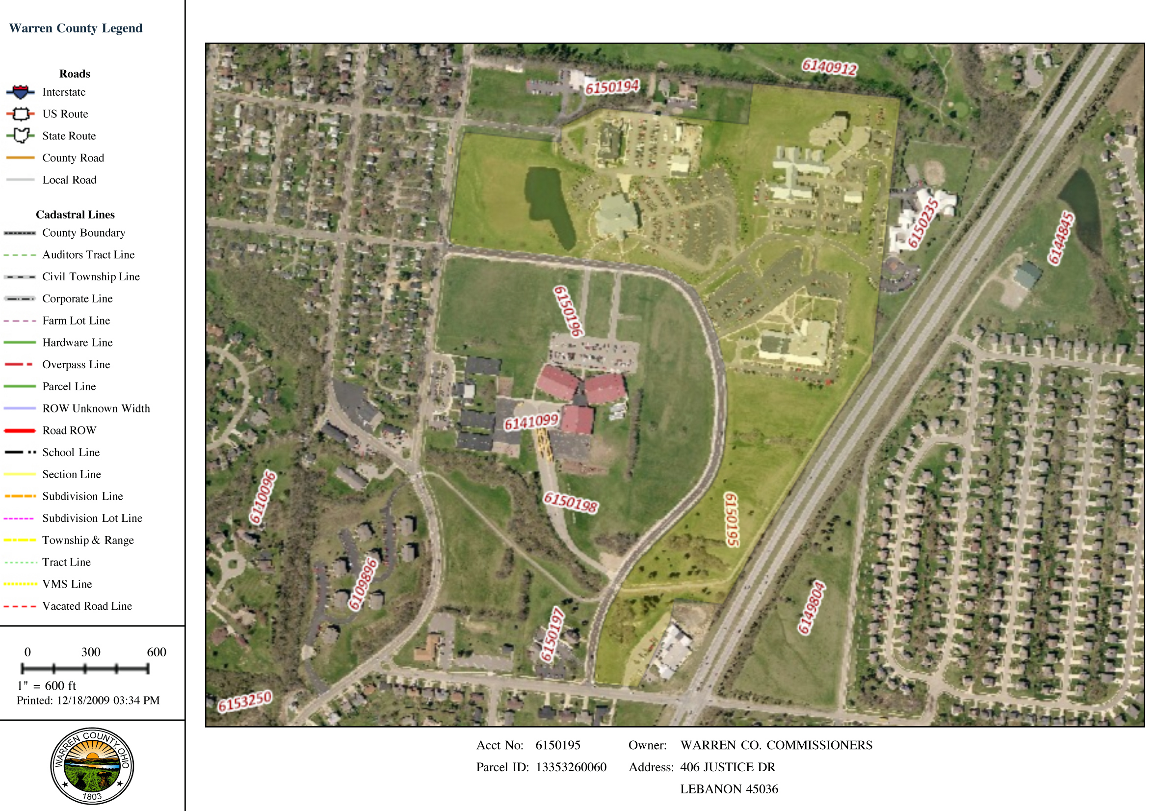
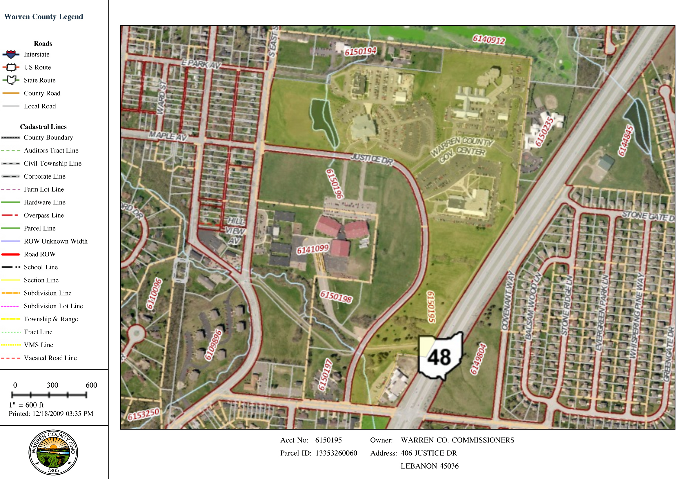
These pages can be printed very easily.
First select the view you want (street, aerial or hybrid). Under the “Map
Contents” select how you want the property to be listed (by account number,
parcel number, street address or none). Select “Create Printable Map”.
There is a spot to name your image. It can be oriented vertical or
landscape. The property details can also be added. This will show the
owner’s name, account number and parcel ID.
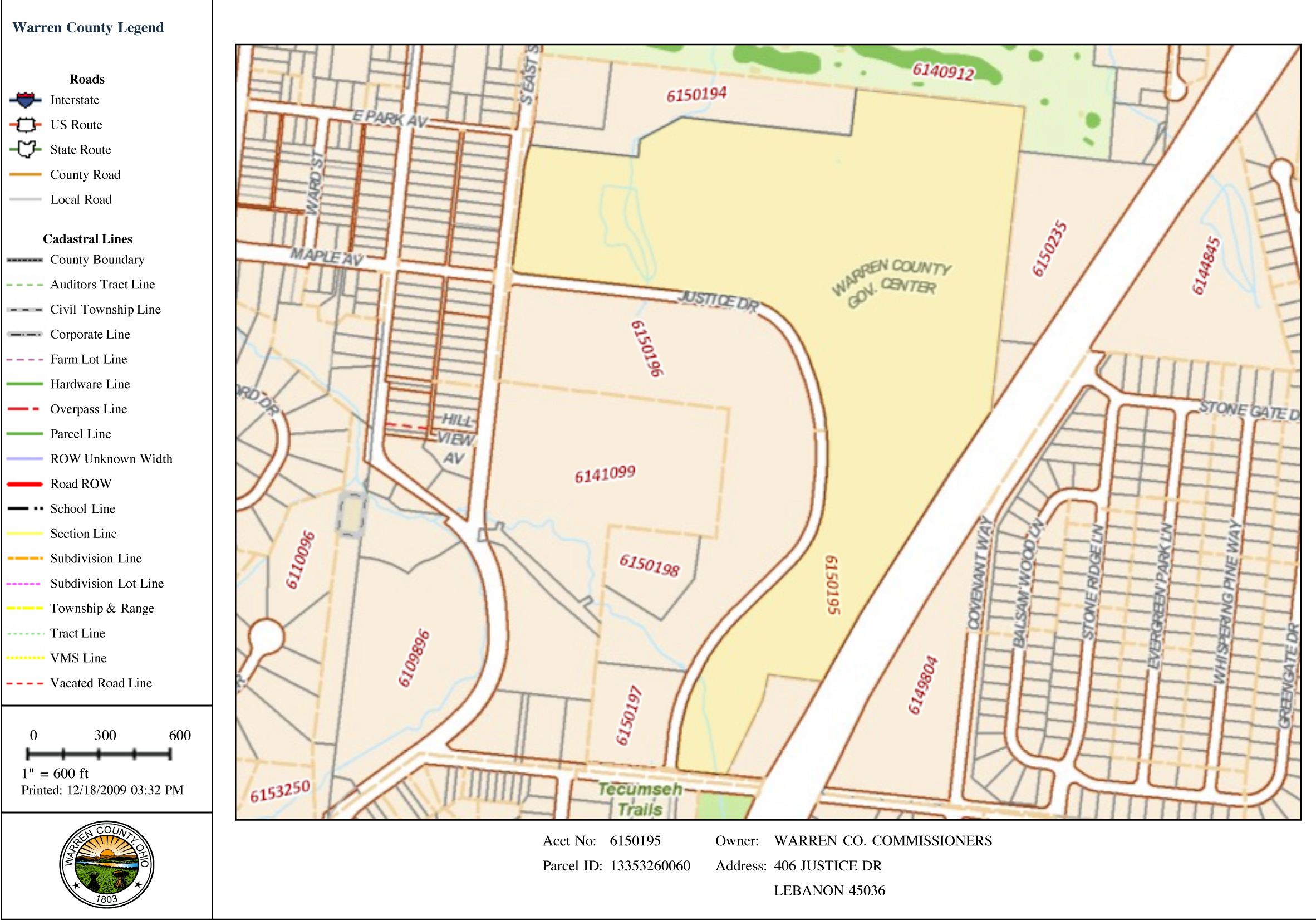
Above: map showing property
account #6150195 street view. Below the aerial view is shown.
 |
Searches done by maps are
immensely helpful. These can be done if you know roughly where your ancestor
lived or died or if you know the property account number. It is much easier
to find it you know the street name. Click on the link for the map at the top
of the property search page. To use the map features you will need to disable
any popup blockers on your computer. Two types of searches can be done: by
specific locality or township, or by typing in the account number. If you
don’t know the account number it is easier to select the locality such as the
town Lebanon from the “Zoom to” drop down menu, and then zoom in and use the
hand to move around until you find your specified property. If you know the
property account number because you first found it using the property search
features on the combined auditor’s and recorder’s search website, then type in
the account number and press the “Go” button. Make sure you type in the
account number not parcel ID. They are not the same thing.
 |
There are many layers
available to add to your map. The most useful to genealogists is making sure
you click the roads / townships, subdivision, parcels and aerial photos. This
shows what the lay of the land really looks like, where the road and township
boundaries fall, and what the properties divisions really are. This can give
you a very idea of the property you are researching and the neighbors, which
may or may not appear listed in the land records you are searching. These
pages can be printed very easily. The map search feature is also useful for
tracking down cemetery locations.
©2009-2011 Warren County Genealogical Society
For Non-commercial Use Only
This page was created on 7 December 2009 and last updated on
11 February 2011