Warren County Genealogical Society
Warren County, Ohio
Maps
This page contains a link to a current map of Warren County and also a link to an older map for the year, 1875. We have access to other maps not listed here. Researchers who are looking for other maps can come into our library and use the ones we have available. For those researchers unable to come in but who would like a copy of a specific map, please contact our research department mentioned on the About Us page.
Click here to see a current Warren County map
Here is a clickable Area Map with links to surrounding county GenWeb sites.
Here is a clickable map of Warren County and the townships
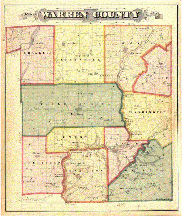
Click here to see the 1875 map for Warren County, Ohio
Ohio Department of Transportation Highway Map of Warren County
Property Records Page at the Warren County Ohio GenWeb
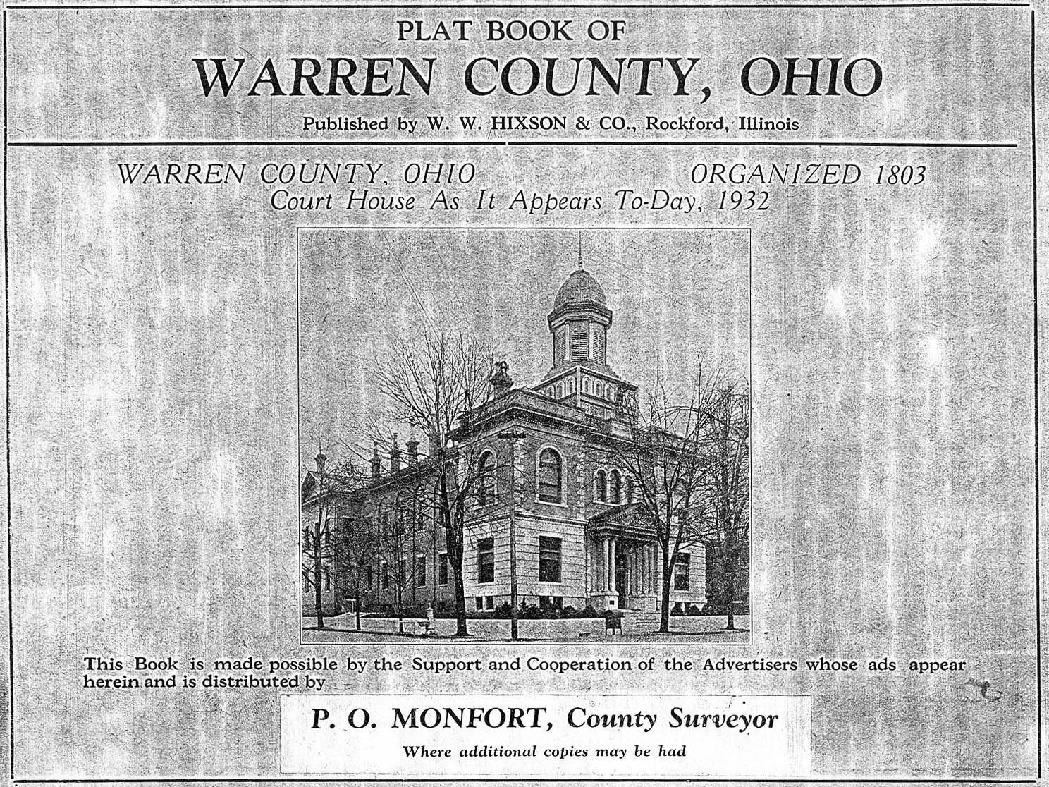
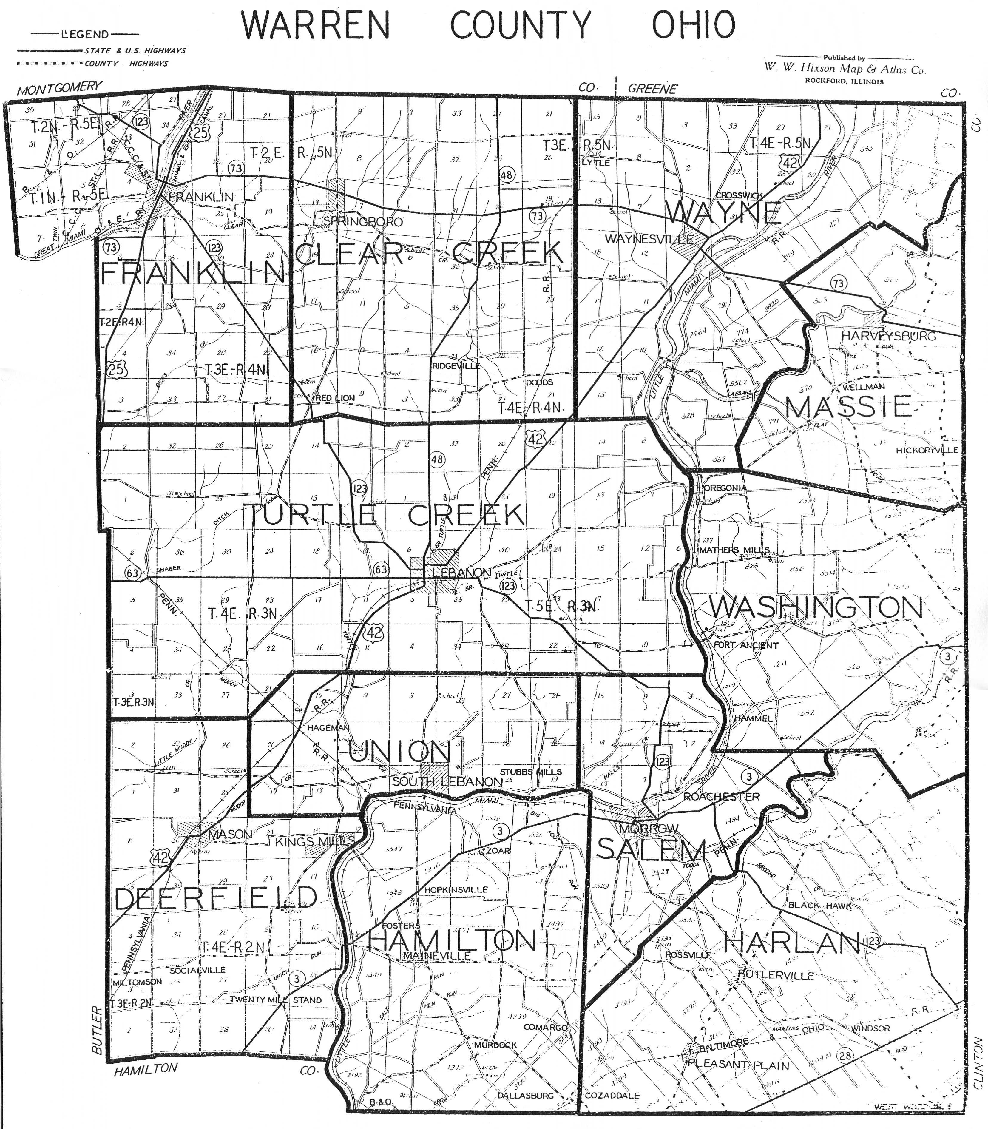
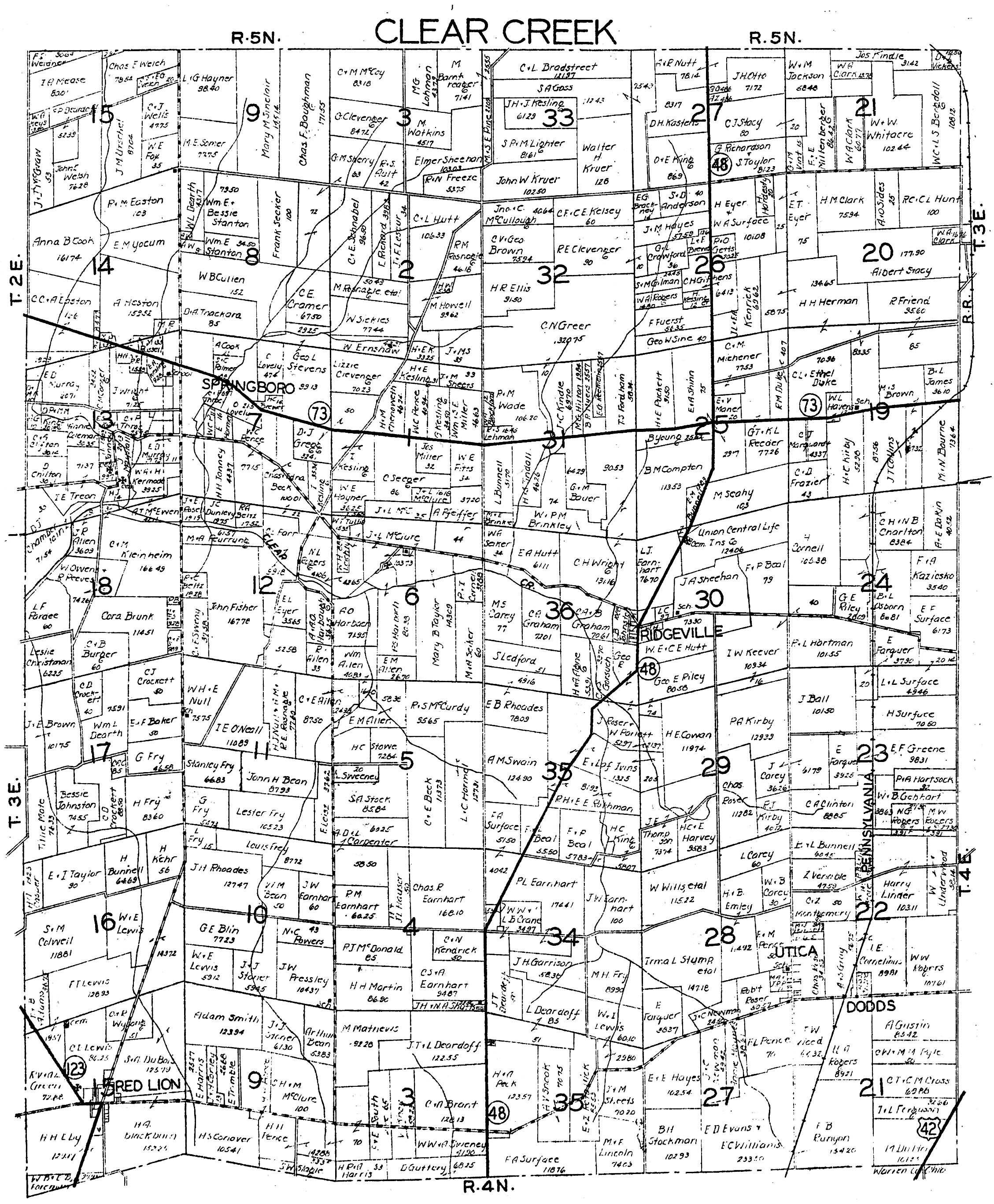
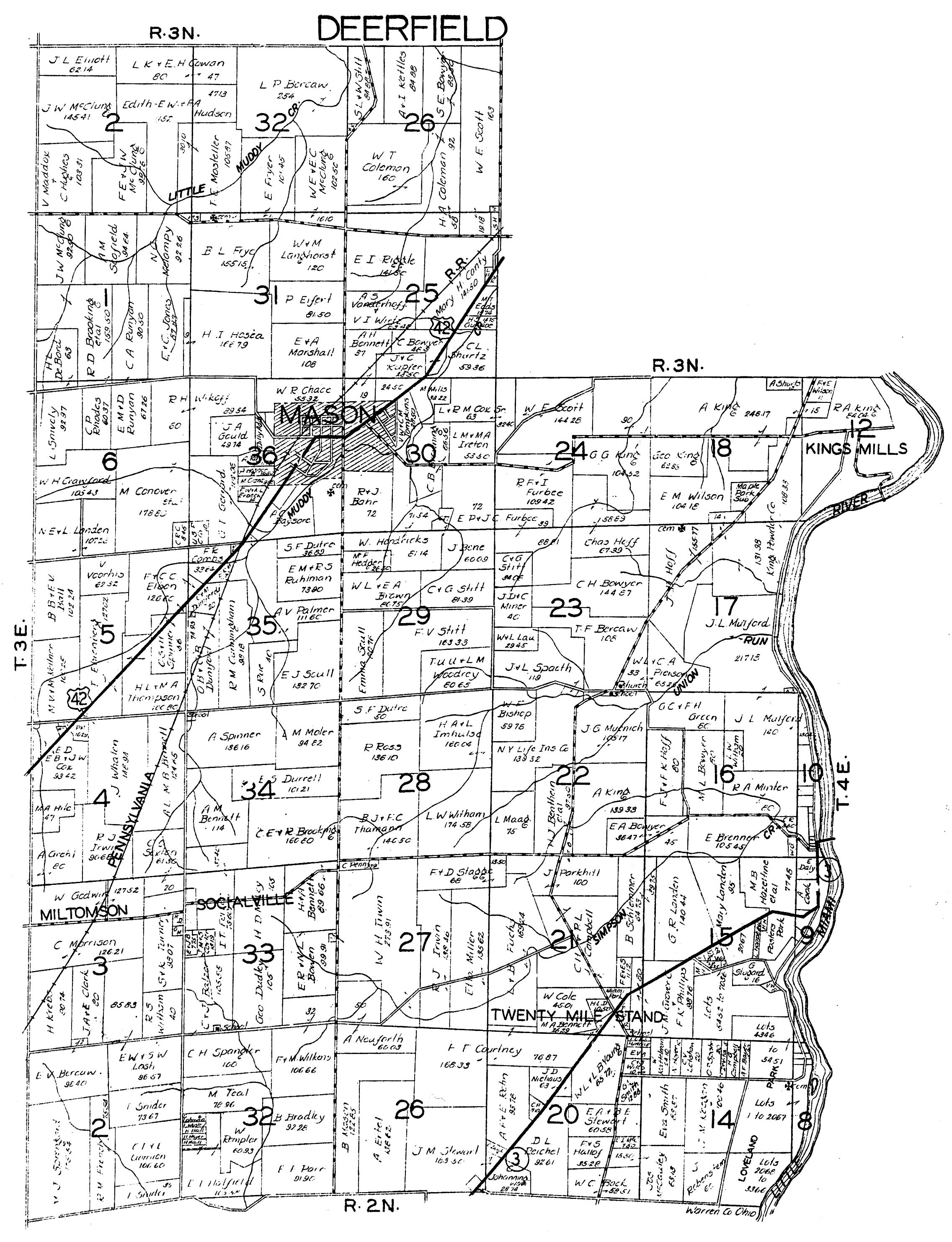
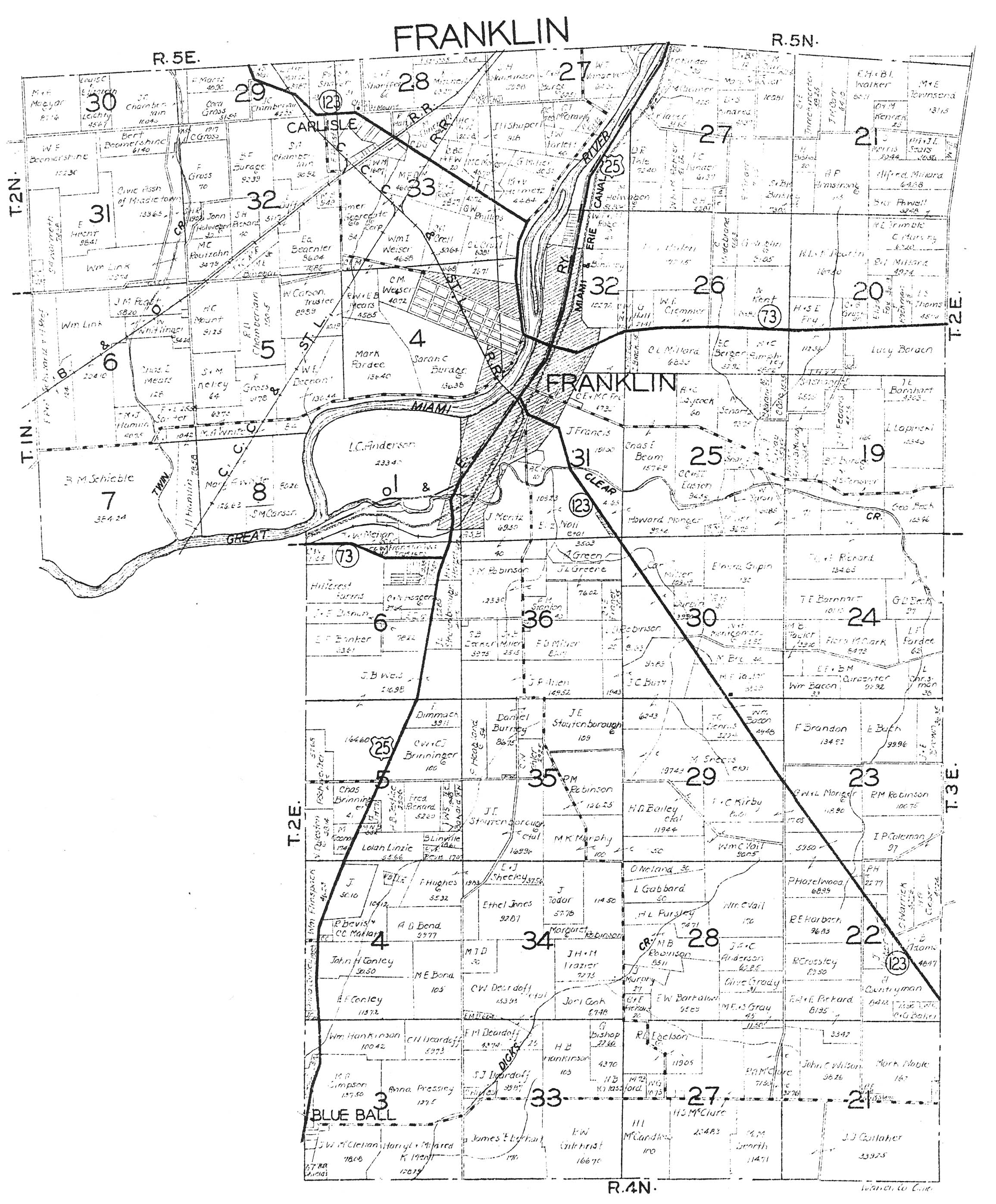
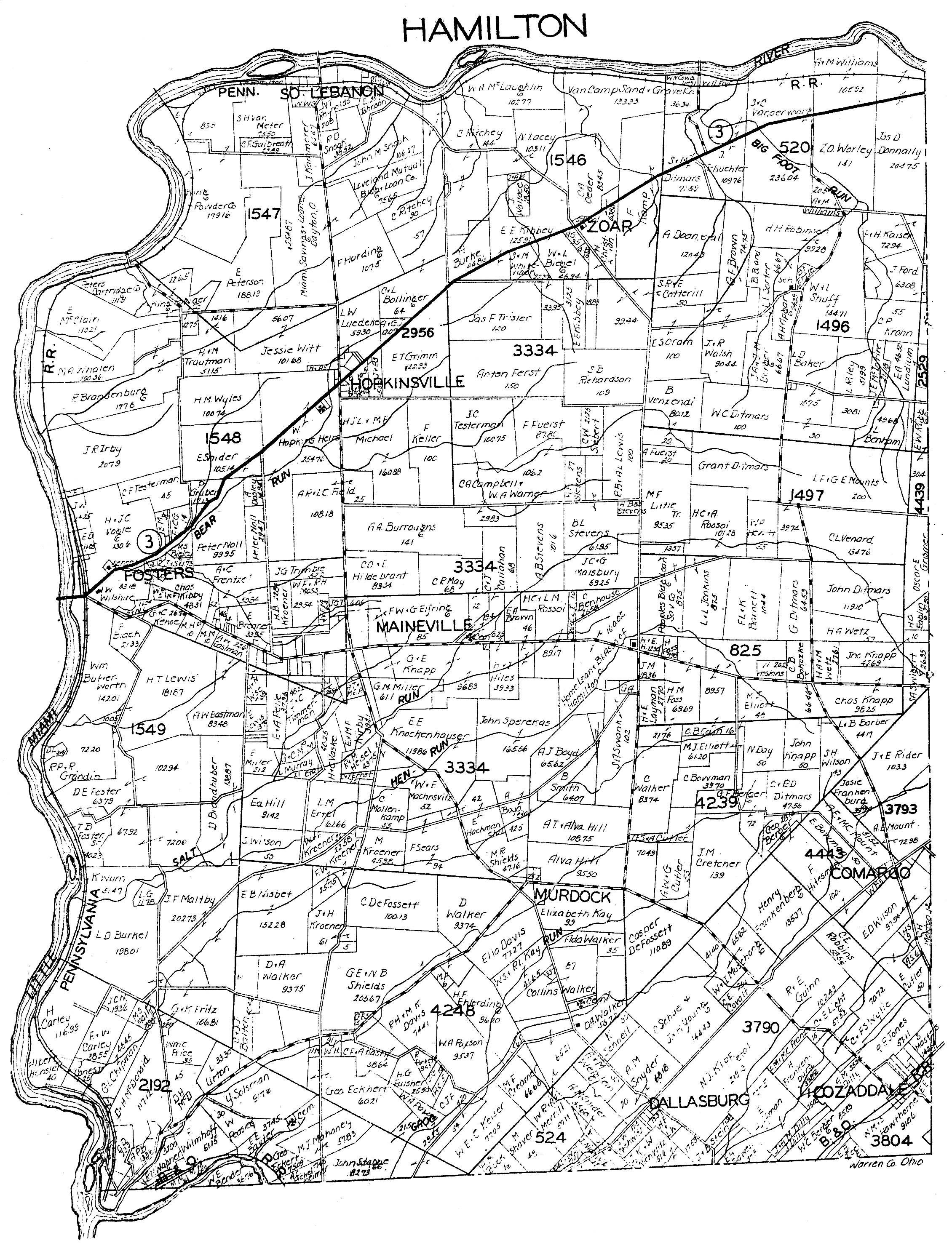
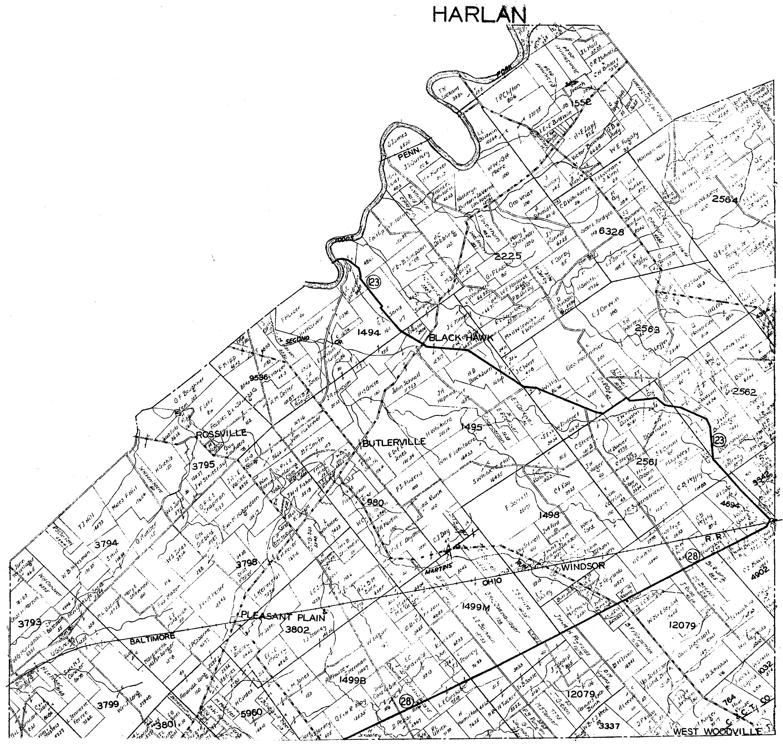
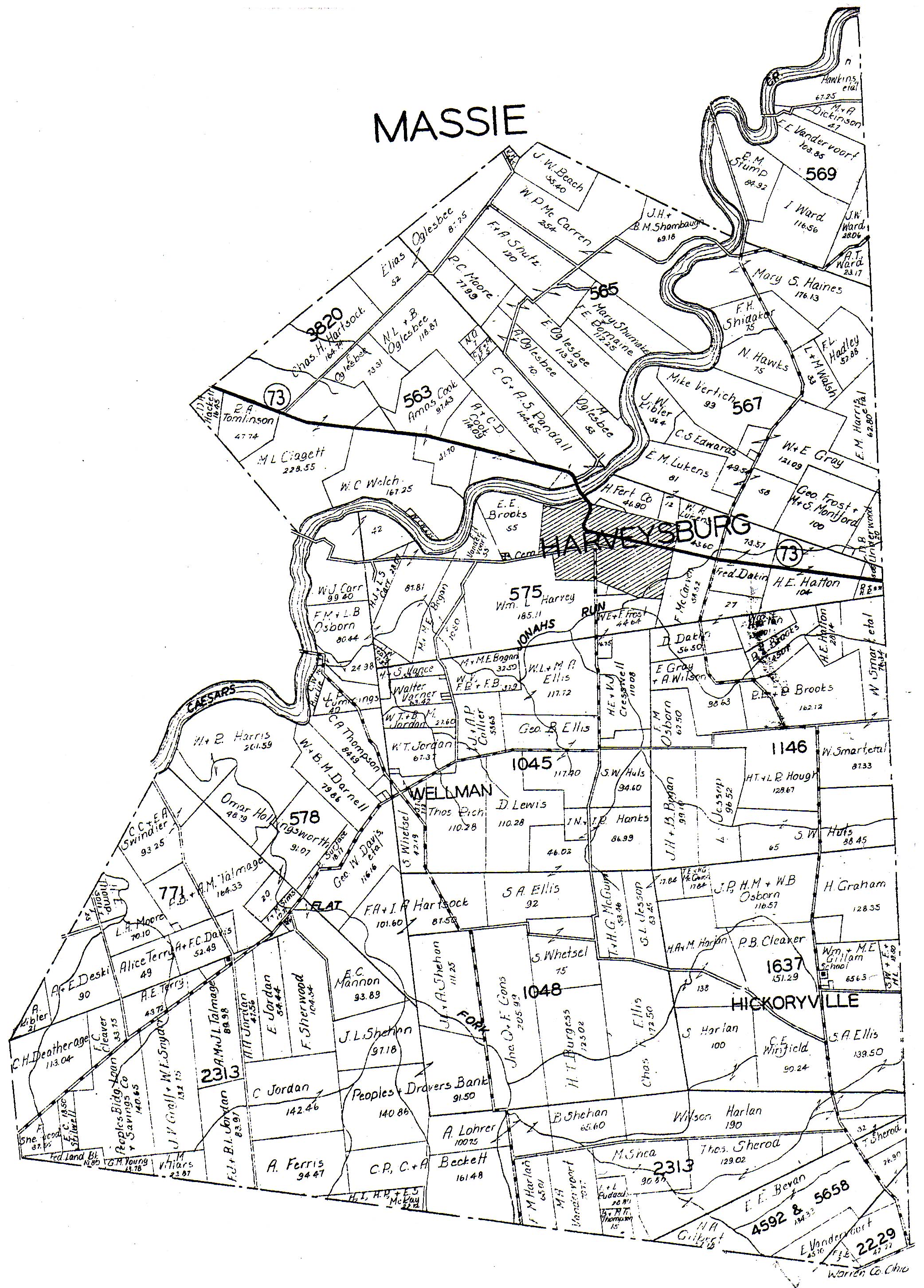
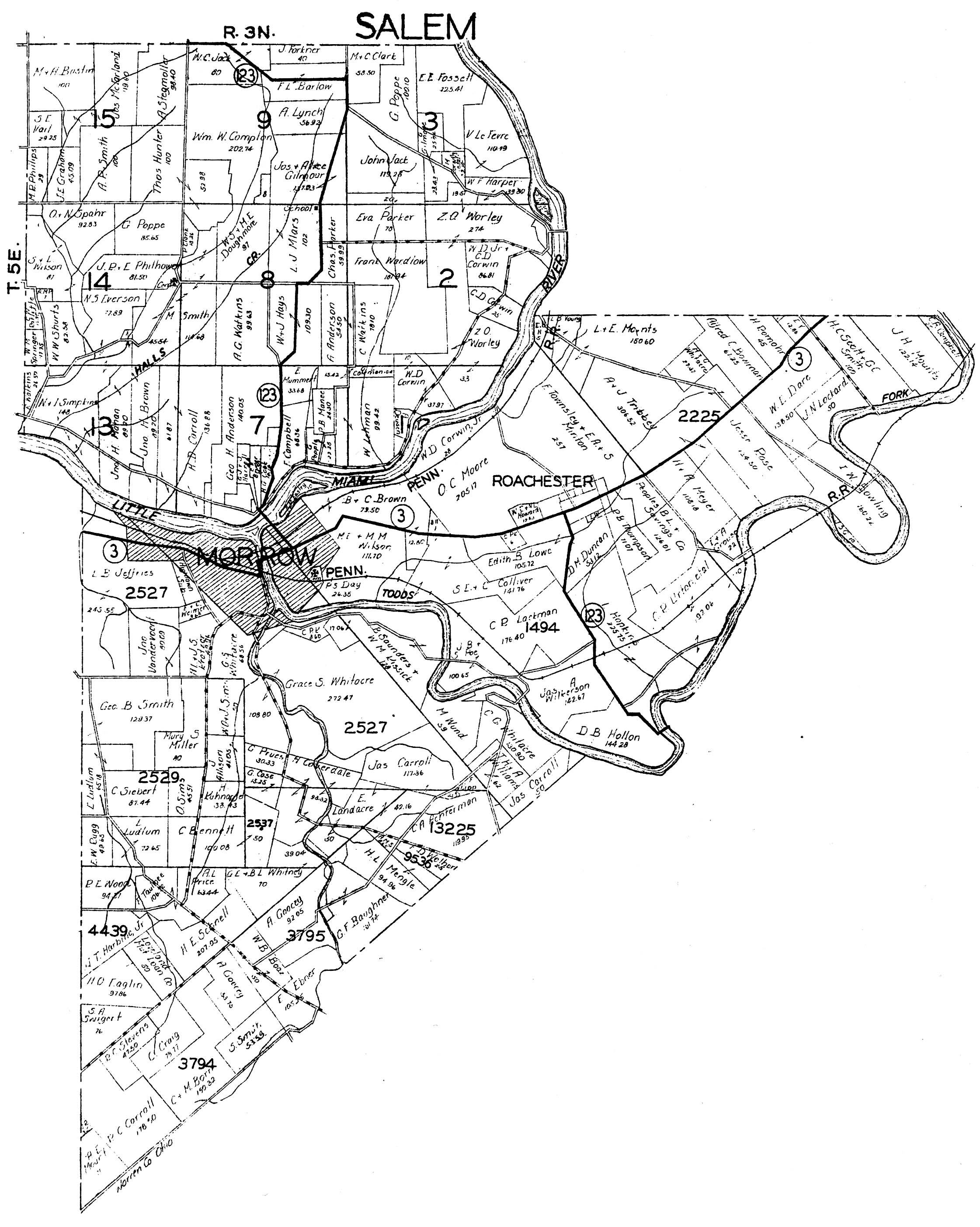
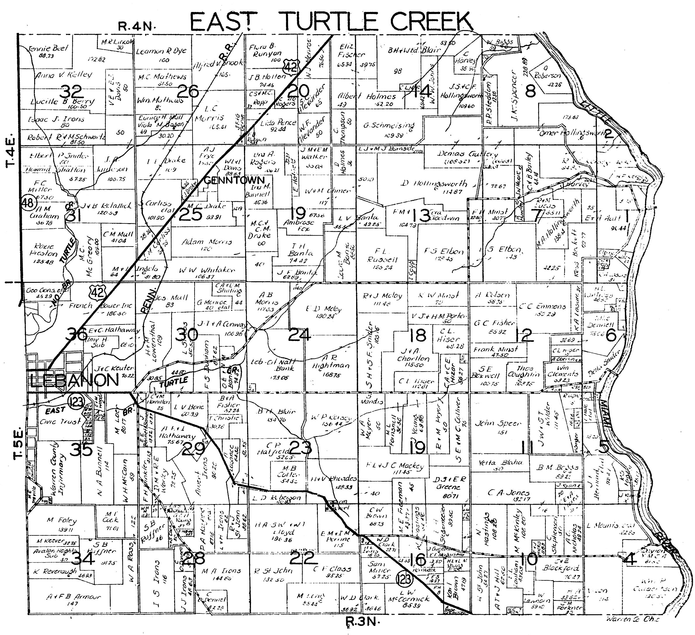
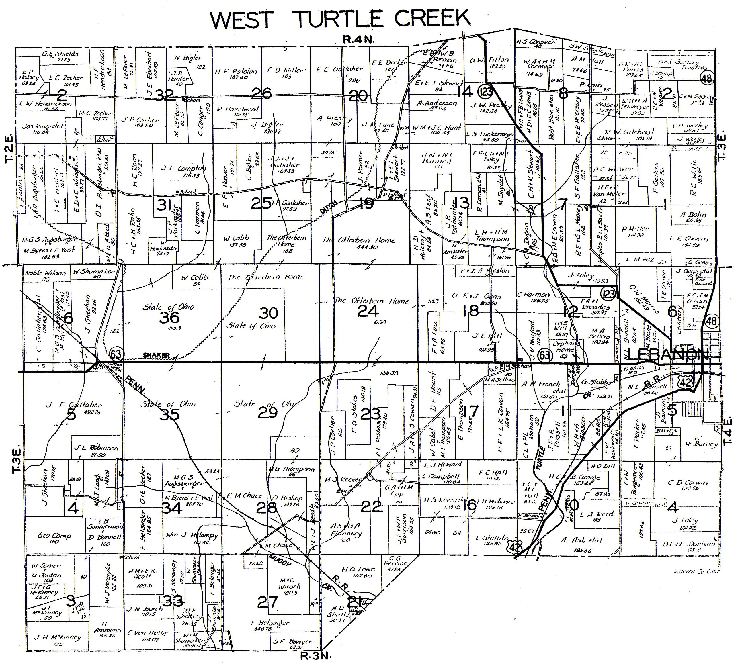
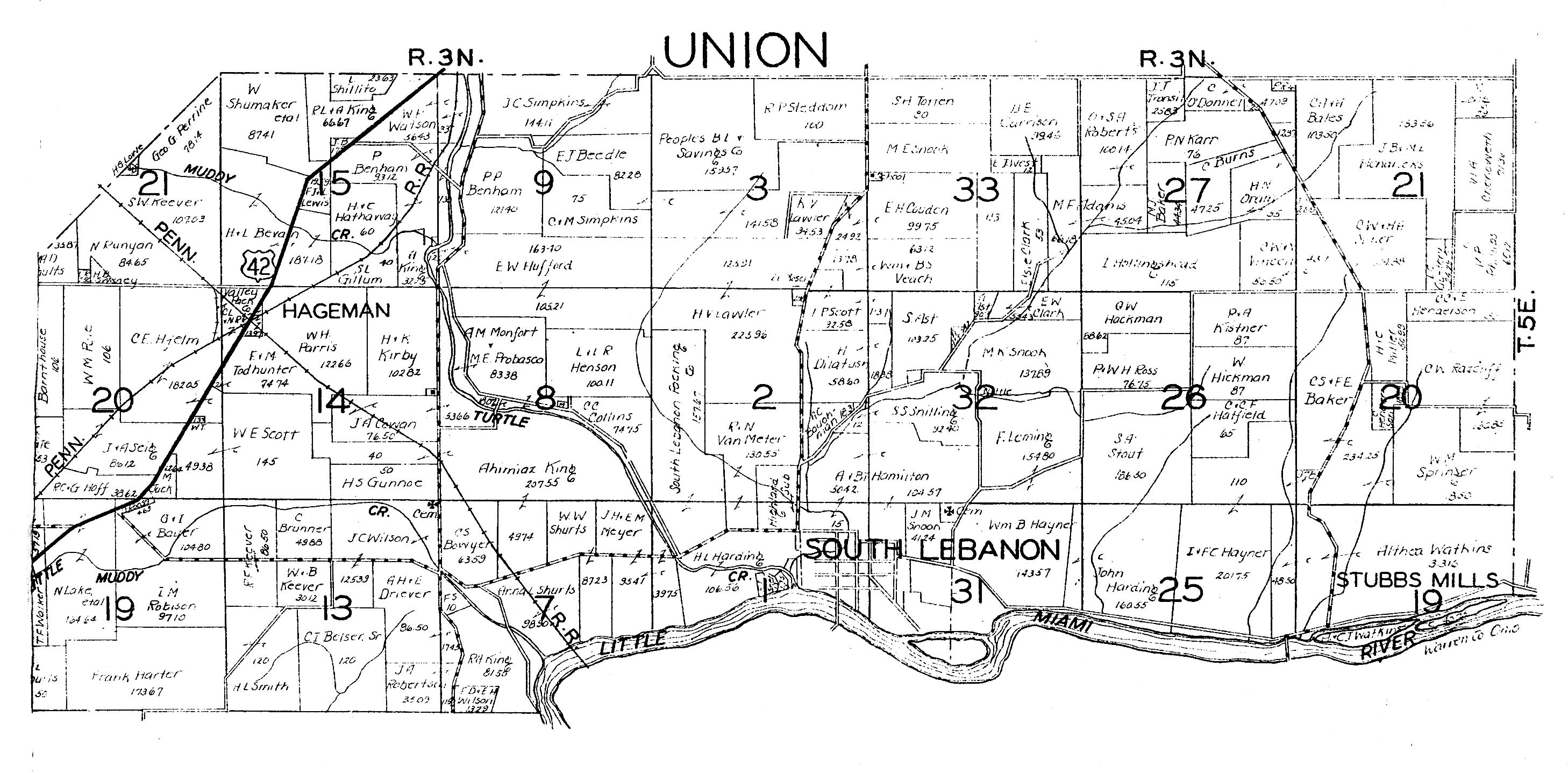
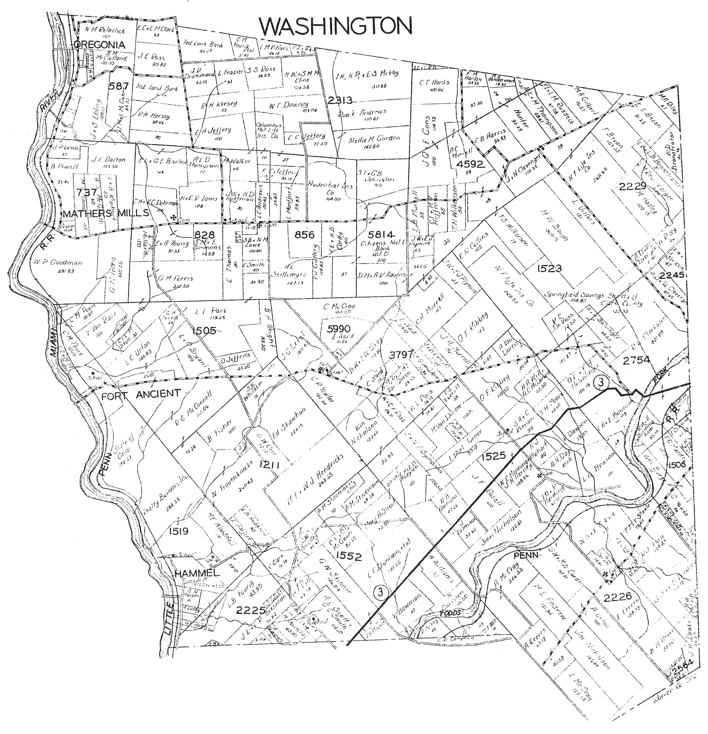
1932 Warren County Plat Book. Images are available below.
WARNING! These
are VERY LARGE FILES!
|
|
|
|
|
|
|
|
|
|
|
|
|
|
|
|
|
|
|
|
|
|
|
|
|
|
|
|
|
|
|
|
©2002, 2003 Warren County Genealogical Society
For Non-commercial Use Only
This page was last updated on
21 August 2003